



Product Information
What is Felt-maps?
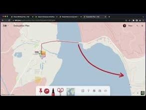
Felt makes it easy for anyone to create and share maps that tell stories—from campsite directions to climate change. For dozens of industries that rely on maps to get work done, Felt is the first user-friendly, collaborative tool designed for teamwork.
How to use Felt-maps?
Felt is a cloud-native GIS platform for easily creating, sharing, and collaborating on maps across industries, helping users tell data-driven stories.
Core Functions of Felt-maps
Create and Share Maps
Team Collaborative Mapping
Upload and Visualize Any Format of Geographic Data
Integration with Multiple Cloud Databases
Build Data Dashboards
Felt AI Space Engineer Assistance
Usage Scenarios of Felt-maps
- Creating Campground Route Maps
- Analyzing Climate Change
- Mapping Work and Collaboration Across Industries
- Urban Planning and Government Management
- Agriculture and Natural Resource Management
- Alternative Professional GIS Software for Spatial Analysis
Common Questions about Felt-maps
What does Felt do?
How do I use Felt?
What are the core features of Felt?
What are the application scenarios for Felt?